Greenfield Exploration Targets
Structural geology and mapping have been used with great success throughout Newfoundland, as a large number of gold deposits discovered across the Province occur along either the main Cape Ray Shear or on second order structures (splays) off the main shear.
Matador engaged highly regarded structural geology consultants Terrane Geoscience, to undertake a structural analysis (using geophysical outputs) and mapping program to assist the Company in better understanding the structures that exist within its tenement package and how these structures control the mineralisation.
In conjunction with this work, a detailed geochemical program, which included both historical work and results from the 2018 field season were combined and analysed. The results from both the structural / geophysics and geochemical programs were overlaid to determine key areas of interest. This analysis identified three high priority targets as highlighted in Image 1 below.
These targets will be further explored at the recommencement of the field season to assist in further refining the drill program planned at each target for later in the year.
Image 1: High priority exploration targets
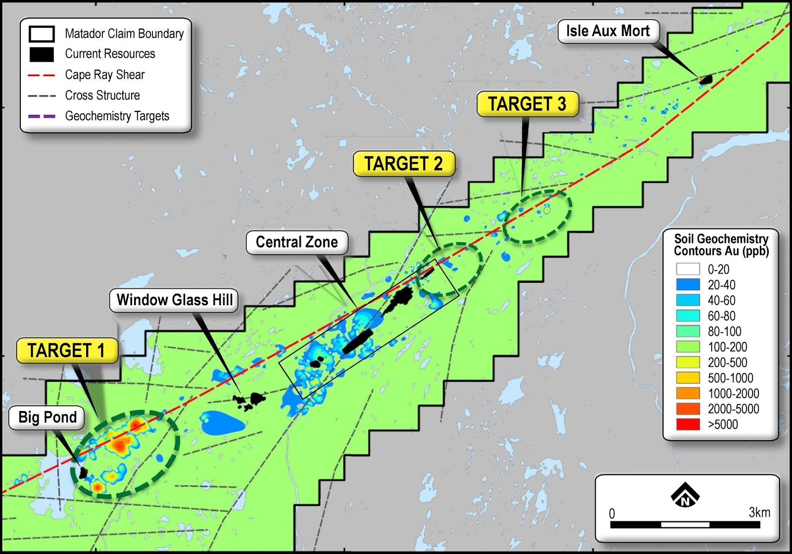
Target 1
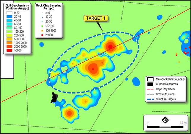
Target 1 is located 1km to the east of the current resource at Big Pond. This target is characterised by a 1km strike length gold in soil anomaly of >500ppb Au and coincident with an area of multiple interpreted cross faults as highlighted in Image 2 below. On a local scale, the target is contained within an area of low magnetic response which is similar to that of the main Central Zone area. The target area is untested by drilling.
Image 2: Target 1 – Geochemical and structural analysis
For more information download the ASX announcement from March 2019.
Target 2
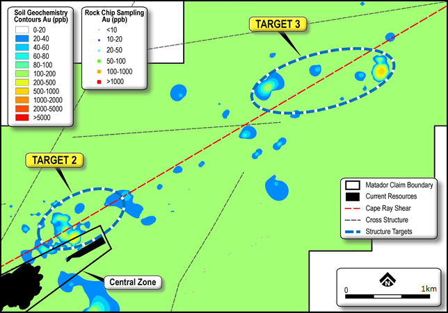
Target 2 is located 100m to the north of the Central Zone extension. This target is characterised by a 100m strike length gold in soil anomaly of >100ppb Au and again coincident with an area of multiple interpreted cross faults as highlighted in Image 3 below. The target area’s close proximity to structures at Central Zone indicate a potential extension of mineralisation along strike to the east of the current defined resource. The target area is untested by drilling.
Image 3: Target 2 & 3 – Geochemical and structural analysis
Target 3
Target 3 is located 2.5km to the east of Central Zone. This target is characterised by a similar coincident soil anomaly of >100ppb Au over 100m and interpreted cross faults as highlighted in Image 3 above. The target is located along the continuation of the mylonite-hydrothermal breccia zone that hosts the eastern margin of the Central Zone resource. The target area is untested by drilling.